Product successfully added to your shopping cart
There are 0 items in your cart. There is 1 item in your cart.

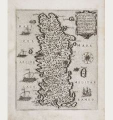
Rhodi Insula nobilissima nel Mare
Natal Bonifacio (*1537 - †1592)Reference 12134
Description
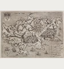
A very fine and rare map of Rhodes by Natale Bonifacio. To the upper left a decorative cartouche with key and the title Li Savii di Rhodi, to the upper right another cartouche. Below left the title cartouche dated In Venetia 1570 and the signature of N. Bonifacio which is weakly visible. Below right a large compass rose in the sea.
Among the most popular cartographic works are the Italian atlases of the 16th century, the so-called Lafreri atlases, an individual composition of maps of different types and sizes. The maps are very rare and can often only be found in large libraries and state collections.
Details
| Cartographer | Natal Bonifacio |
| Title | Rhodi Insula nobilissima nel Mare |
| Publisher, Year | Venice, circa 1570 |
| Plate Size | 31.3 x 24.3 cm (12.3 x 9.6 inches) |
| Sheet Size | 32.3 x 25.8 cm (12.7 x 10.2 inches) |
| Reference | Bifolco S. & Ronca F.: Cartografia e topografia italiana del XVI secolo, No. 770; Meurer, P.H.: The Strabo Illustratus Atlas, No. 75; Tooley, R.V.: Maps in Italian Atlases of the Sixteenth Century, No. 466; Zacharakis, C. G.: A Catalogue of printed Maps of Greece, 3rd edition, #3487/2274 |
Condition
Cartographer
Images to Download
If you like to download the image of this map with a resolution of 1200 pixels, please follow the link below.
You can use this image for publication on your personal or commercial websites for free if you set a link to this website. If you need photographs with a higher resolution, please contact us.
Greece - Bonifacio, Natal - Rhodi Insula nobilissima nel Mare


![[Candia, Crete, Karpathos] [Candia, Crete, Karpathos]](https://www.vintage-maps.com/2939-home_default/bordone-greece-crete-and-karpathos-1528-1565.jpg)
![[Euboea, Negroponte, Bosporus, Istanbul] [Euboea, Negroponte, Bosporus, Istanbul]](https://www.vintage-maps.com/2937-home_default/bordone-greece-negroponte-euboea-1528-1565.jpg)
