Product successfully added to your shopping cart
There are 0 items in your cart. There is 1 item in your cart.
Total products
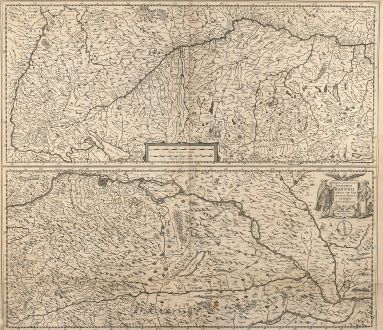
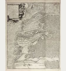
Maximi Totius Europae Fluminis Danubii Cursus per Germaniam Hungariamque Nova Delineatio
Jodocus Hondius (*1563 - †1612)Antique map of the Danube Course. Printed in Amsterdam by H. Hondius circa 1635.
Reference 10679
Description
Nice mid 17th century copper engraved map of the course of the river Danube in two sections by H. Hondius. With one cartouche and a mileage scale. Rare separate issued sheet without the text on verso.
Details
| Cartographer | Jodocus Hondius |
| Title | Maximi Totius Europae Fluminis Danubii Cursus per Germaniam Hungariamque Nova Delineatio |
| Publisher, Year | H. Hondius, Amsterdam, circa 1635 |
| Plate Size | 44.8 x 51.0 cm (17.6 x 20.1 inches) |
| Sheet Size | 45.4 x 54.2 cm (17.9 x 21.3 inches) |
Condition
Lower margin just cut into the frame, centrefold and lower area backed with Japan paper, some crease around centrefold, horizontal crease in lower third backed, one small wax spot.
Cartographer
Jodocus Hondius was born 1563 in Wakken (West Flanders). He became a globe maker and map engraver. In 1593 he set up his business in Amsterdam after he spent several years in London. He was one of the most important engravers of his time and engraved maps for van den Keere, Waghenaer and Speed. Hondius bought the plates of Mercator in 1604, added around 40 maps and published the expanded Mercator-Atlas first 1606 still under Mercator's name. After his death 1612 in Amsterdam, the business was carried out by his sons Jodocus II and Henricus.
Images to Download
If you like to download the image of this map with a resolution of 1200 pixels, please follow the link below.
You can use this image for publication on your personal or commercial websites for free if you set a link to this website. If you need photographs with a higher resolution, please contact us.
Jodocus Hondius: Maximi Totius Europae Fluminis Danubii Cursus per Germaniam Hungariamque Nova Delineatio.
Antique map of the Danube Course. Printed in Amsterdam by H. Hondius circa 1635.
Germany - Hondius, Jodocus - Maximi Totius Europae Fluminis Danubii...

![[Donau Strom von Sigmaringen bis Donauwörth] [Donau Strom von Sigmaringen bis Donauwörth]](https://www.vintage-maps.com/2606-home_default/anonymous-germany-baden-wuerttemberg-danube-1702.jpg)



![[De Boemia. / Tabula quarta & quinta Europae de nonnullis / Germaniae ...] [De Boemia. / Tabula quarta & quinta Europae de nonnullis / Germaniae ...]](https://www.vintage-maps.com/2304-home_default/fries-germany-1541.jpg)
