Product successfully added to your shopping cart
There are 0 items in your cart. There is 1 item in your cart.
Total products
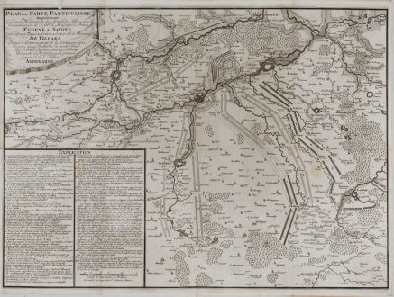
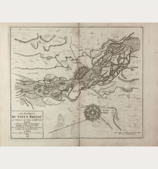
Plan, ou Carte Particuliere representant les divers Mouvements des Armees des Alliees,...
Pieter van Call (*1688 - †1737)Antique map of the Battle of Denain (Bataille de Denain). Printed in The Hague by T. Johnson in 1713.
Reference 11226
Description
Very rare and detailed plan of the Battle of Denain on 24 July 1712, part of the War of the Spanish Succession. T. Johnson published a report on Denain in 1713, avec une carte, apparently this one. With Cambrai, Bouchain, Douai, Arras, Valenciennes and Le Quesnoy.
We could only find a few copies of this map in public libraries and collections worldwide.
Details
| Cartographer | Pieter van Call |
| Title | Plan, ou Carte Particuliere representant les divers Mouvements des Armees des Alliees, sous le Commandement de S. A. S. Monseign.r Le Prince Eugene de Savoye. Et de l'Armee francoise commandee par Mr. le Marechal de Villars. Depuis le Commencement... |
| Publisher, Year | T. Johnson, The Hague, 1713 |
| Plate Size | 44.2 x 60.5 cm (17.4 x 23.8 inches) |
| Sheet Size | 52.5 x 63.0 cm (20.7 x 24.8 inches) |
Condition
Old mounted on thin paper, since the map was originally bound into a composite atlas. Very good condition.
Cartographer
Pieter van Call was a Dutch geographer, cartographer and surveyor who worked in The Hague at the beginning of the 18th century.
Images to Download
If you like to download the image of this map with a resolution of 1200 pixels, please follow the link below.
You can use this image for publication on your personal or commercial websites for free if you set a link to this website. If you need photographs with a higher resolution, please contact us.
Pieter van Call: Plan, ou Carte Particuliere representant les divers Mouvements des Armees des Alliees, sous le Commandement de S. A. S.....
Antique map of the Battle of Denain (Bataille de Denain). Printed in The Hague by T. Johnson in 1713.
France - Call, Pieter van - Plan, ou Carte Particuliere representant...


