Product successfully added to your shopping cart
There are 0 items in your cart. There is 1 item in your cart.
Total products

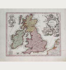
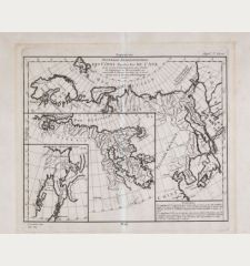
Les Isles Britanniques qui Comprennent les Royaumes d'Angleterre, d'Ecosse et d'Irlande
Gilles Robert de Vaugondy (*1688 - †1766)Antique map of the British Isles. Printed in Paris circa 1754.
Reference 10161
Description
Coloured map of the British Isles from Gilles Robert de Vaugondy. With inset map of the Orkneys, Shetlands and Faroe Islands. Attractive cartouche with coat of arms.
Details
| Cartographer | Gilles Robert de Vaugondy |
| Title | Les Isles Britanniques qui Comprennent les Royaumes d'Angleterre, d'Ecosse et d'Irlande |
| Publisher, Year | Paris, circa 1754 |
| Plate Size | 48.0 x 58.5 cm (18.9 x 23.0 inches) |
| Reference | Pedley, M.S. 43 |
Condition
Overall browning, some foxing, missing piece in centre of top margin, vertical large tear left of centrefold largely backed with old paper also slightly visible from front side.
Cartographer
Gilles Robert de Vaugondy, a French cartographer with connection to the Sanson family, was born 1688 in Paris. He used Sanson's plates and also acquired plates of Jaillot. His major work was the beautiful Atlas Universel first issued in 1757. He died 1766 in Paris.
Images to Download
If you like to download the image of this map with a resolution of 1200 pixels, please follow the link below.
You can use this image for publication on your personal or commercial websites for free if you set a link to this website. If you need photographs with a higher resolution, please contact us.
Gilles Robert de Vaugondy: Les Isles Britanniques qui Comprennent les Royaumes d'Angleterre, d'Ecosse et d'Irlande.
Antique map of the British Isles. Printed in Paris circa 1754.
British Isles - Robert de Vaugondy, Gilles - Les Isles Britanniques qui Comprennent les...


![[British Isles and England & Wales] [British Isles and England & Wales]](https://www.vintage-maps.com/2941-home_default/bordone-british-isles-england-and-wales-1528-1565.jpg)

![[The Firth of Murry] - To the Rt Hon.ble, my Lord Viscount Torbat, Lord Register of the Kingdom of Scotland [The Firth of Murry] - To the Rt Hon.ble, my Lord Viscount Torbat, Lord Register of the Kingdom of Scotland](https://www.vintage-maps.com/2244-home_default/collins-scotland-north-sea-moray-firth-inverness.jpg)
