Menu
- Antique Maps
- Atlases
- Globes
- Cartographers
- Aa, Pieter van der
- Adams, John
- Adrichem, Christian
- Albizzi, Antonio
- Allard, Carel
- Allard, Hugo
- Altmannshausen, Johann Ernst von
- Angelocrator, Daniel
- Anguissola, Leander
- Anonymous
- Bachmann, John
- Bailleul le Jeune, Nicolas
- Barbault, Jean
- Bayer, Johann
- Beaurain, Jean de
- Beek, Anna
- Belleforest, Francois de
- Bellin, Jacques Nicolas
- Bellus, Nicolaus
- Bertius, Petrus
- Bibliographisches Institut
- Bickham, George
- Blaeu, Joan
- Blaeu, Willem Janszoon
- Bodenehr, Gabriel
- Bodmer, Karl
- Boethius, Christoph
- Bonifacio, Natal
- Bonne, Rigobert
- Bordone, Benedetto
- Borgia, Stefano
- Botero, Giovanni
- Bowen, Emanuel
- Bowles and Carver
- Bowles, Thomas
- Braun & Hogenberg
- Breydenbach, Bernhard von
- Brion de la Tour, Louis
- British Admiralty
- Bry, Theodor de
- Bucelin, Gabriel
- Buffon, G.-L. Leclerc de
- Bünting, Heinrich
- Bussemacher, Johann
- Call, Pieter van
- Camocio, Giovanni Francesco
- Caoursin, Guillaume
- Cary, John
- Cellarius, Andreas
- Celtis, Konrad
- Chaffat, Antoine du
- Chapman and Hall
- Clouet, Jean Baptiste Louis
- Clüver, Phillip
- Collins, Greenville
- Coronelli, Vincenzo Maria
- Covens and Mortier
- Curtis, William
- d'Anville, Jean Baptiste
- Danckerts, Justus
- Danckerts, Theodorus
- de l'Isle, Guillaume
- De Pierre
- Delamarche, Charles Francois
- Deroy, Isidore Laurent
- Doncker, Hendrick
- Doppelmayr, Johann Gabriel
- Downing, Alexander
- Drummond, Alexander
- Dudley, Robert
- Duflos, Claude
- Edwards, Sydenham Teak
- Ellis, Joseph
- Elwe, Jan Barend
- Euler, Leonhard
- Faden, William
- Fer, Nicolas de
- Flinders, Matthew
- Fouquet, Pieter
- Fourdrinier, Pierre
- Fricx, Eugene Henri
- Fries, Laurent
- Garden, Francis
- Geographisches Institut Weimar
- Goos, Abraham
- Goos, Pieter
- Greenwood, Christopher
- Haffner, Johann Christoph
- Haupt, Gottfried Jacob
- Holle, Lienhart
- Homann Erben
- Homann, Johann Baptist
- Homann, Johann Christoph
- Hondius, Jodocus
- Hondt, Pieter de
- Hooker, William
- Husson, Pierre
- Jaillot, Alexis Hubert
- Janssonius, Johannes
- Jefferys, Thomas
- Jode, Gerard de
- Johnston, Alexander Keith
- Jombert, Charles Antoine
- Jonston, John
- Julien, Roch Joseph
- Keere, Pieter van den
- Keulen, Johannes van
- Kilian, Georg Christoph
- Kip, William
- Kitchin, Thomas
- Langlois, Hyacinthe
- Laurie & Whittle
- le Clerc, Nicolas Gabriel
- le Rouge, George Louis
- Lempriere, Clement
- Lespinasse, Nicolas Louis de
- Lesson, René Primevère
- Linschoten, Jan Huygen van
- Little, William
- Loots, Johannes
- Lotter, Tobias Conrad
- Magini, Giovanni Antonio
- Magnus, Olaus
- Mallet, Alain Manesson
- Mann, Fred & Helen
- Mannevillette, Jean Baptiste
- Mariette, Jean
- Mayer, Tobias
- Medina, Pedro de
- Megenberg, Konrad von
- Meissner, Daniel
- Mejer, Johannes
- Mercator, Gerard
- Mercator, Michael
- Mercator, Rumold
- Merian, Maria Sibylla
- Merian, Matthäus
- Middiman, Samuel
- Montanus, Arnoldus
- Morden, Robert
- Mortier, David
- Mortier, Pieter
- Mosley, Charles
- Mount & Page
- Münster, Sebastian
- Mynde, James
- Nolin, Jean Baptiste
- Noort, Olivier van
- Norden, Frederick Louis
- Ortelius, Abraham
- Ottens, Reiner
- Owen & Bowen
- Peck, Francis
- Pigeot, Francois
- Pitt, Moses
- Pluche, Noel Antoine
- Poggibonsi, Niccolo da
- Porcacchi, Tomaso
- Porro, Girolamo
- Ptolemaeus, Claudius
- Pufendorf, Samuel Baron von
- Quad, Matthias
- Raigniauld, Henry
- Ramusio, Giovanni Battista
- Rastrick, Gulielmus
- Regnault, Nicolas François
- Reilly, Franz Johann Joseph von
- Renard, Louis
- Riemer, Jacob de
- Robert de Vaugondy, Gilles
- Robert, Nicolas
- Rocque, Barthélemy de La
- Rocque, John
- Rossetti, Domenico
- Rossi, Giovanni Giacomo
- Roy, Bernard de
- Ruscelli, Girolamo
- Russell, John
- Sanson, Nicolas
- Saur, Abraham
- Schedel, Hartmann
- Schenk, Pieter
- Scheuchzer, Johann Jakob
- Schindelmayer, Carl Robert
- Schley, Jakob van der
- Schmidt, Johann Friedrich Julius
- Schotanus van Sterringa, Bernhard
- Schreiber, Johann Georg
- Schwabe, Johann Joachim
- Seale, Richard William
- Seller, John
- Seutter, George Matthäus
- Shaw, Thomas
- Smallegange, Mattheus
- Smith, Charles
- Speed, John
- Stampioen, Jan Janszoon
- Stieler, Adolf
- Stockdale, John
- Stöcklein, Joseph
- Stoopendaal, Daniel
- Sylvanus, Bernardus
- Tallis, John
- Tardieu, Pierre François
- Thornton, John
- Tirinus, Jacobus
- Tirion, Isaak
- Toms, William Henry
- Ughi, Lodovico
- Valegio, Francesco
- Valk & Schenk
- Valk, Gerard
- Verneau, Charles
- Vidal y Pinilla, Felipe
- Visscher, Nicolas
- Waghenaer, Lucas Janszoon
- Waldseemüller, Martin
- Weigel, Christoph
- Weis, Franz Joseph
- Wells, Edward
- Whitbread, Josiah
- Wit, Frederick de
- Wytfliet, Cornelius
- Zenoi, Domenico
- Zoutman, Jan Dirksz
- Graphics
- New Additions
Cart
0 Product: Products: (empty)
No products
Product successfully added to your shopping cart
There are 0 items in your cart. There is 1 item in your cart.
Total products
Continue shopping Proceed to checkout
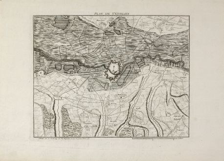
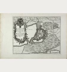
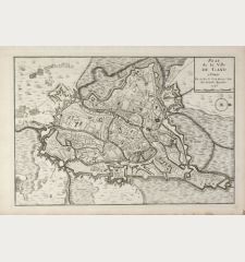
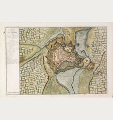
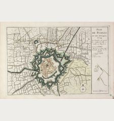
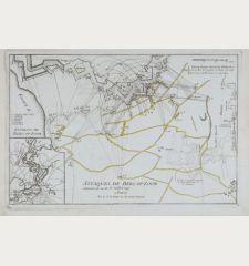
Plan de St. Guislain
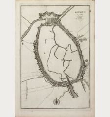
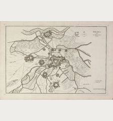
George Louis le Rouge (*1707 - †1790)Antique map of Saint-Ghislain, Hainaut. Printed in Paris by G. L. le Rouge in 1745.
Reference 11130
Description
A rare plan of Saint-Ghislain in the province of Hainaut by Le Rouge. Showing the fortified city and detailed surroundings. Title on top. With a compass rose and mileage scale.
Details
| Cartographer | George Louis le Rouge |
| Title | Plan de St. Guislain |
| Publisher, Year | G. L. le Rouge, Paris, 1745 |
| Plate Size | 27.6 x 33.4 cm (10.9 x 13.1 inches) |
| Sheet Size | 36.2 x 53.2 cm (14.3 x 20.9 inches) |
Condition
Very good conditions.
Cartographer
G. L. le Rouge was a French military engineer, hydrographer and cartographer. He produced a wide rang of attractive cartographic work. He held a position of Geographical Engineer to King Louis XV.
Images to Download
If you like to download the image of this map with a resolution of 1200 pixels, please follow the link below.
You can use this image for publication on your personal or commercial websites for free if you set a link to this website. If you need photographs with a higher resolution, please contact us.
George Louis le Rouge: Plan de St. Guislain.
Antique map of Saint-Ghislain, Hainaut. Printed in Paris by G. L. le Rouge in 1745.

