Product successfully added to your shopping cart
There are 0 items in your cart. There is 1 item in your cart.
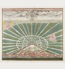
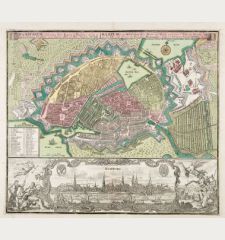
Symbolische Sinnreiche in einer Belagerung... Versuchungen der Liebe... Representation...
George Matthäus Seutter (*1678 - †1757)Reference 12420
Description
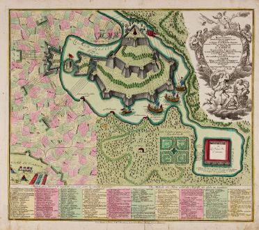
Seutter's famous allegorical map representing the battle of the sexes and of love. In style of a typical 18th century battle plan.
Jeffrey N. Peters describes this map in The History of Cartography, Vol 4, Allegorical and Satirical Maps, as follows:
The German publisher Matthäus Seutter included a map showing the attaques de l'amour in his Atlas novus. This bilingual map in German and French describes, as the legend says, a "methode of defending and preserving one's heart against Love's attacks." It combines both the battle plan of Callières's allegory - a military fort surrounded by a Glacial Sea (La Mer Glacee) and assaulted by the cannon blasts of pleasure and desire - with Scudéry's cartographic language of negotiated seduction.
At the bottom a bilingual index in German and French with innumerable methods to defend and protect the heart against the attacks of love.
Details
| Cartographer | George Matthäus Seutter |
| Title | Symbolische Sinnreiche in einer Belagerung... Versuchungen der Liebe... Representation symbolique et ingenieuse projettée... les attaques de l'amour |
| Publisher, Year | G. M. Seutter, Augsburg, circa 1740 |
| Plate Size | 49.5 x 56.7 cm (19.5 x 22.3 inches) |
| Sheet Size | 54.0 x 61.3 cm (21.3 x 24.1 inches) |
| Reference | Hill, G.: Cartographic Curiosities, Fig. 65; Peters, J. N.: The History of Cartography, Vol 4, Allegorical and Satirical Maps, Fig. 55. |
Condition
Cartographer
George Matthaus Seutter, a German publisher, cartographer and engraver from Augsburg, was born 1678 as the son of a goldsmith. After an apprenticeship at J. B. Homann in Nuremberg, he returned to his native city of Augsburg and worked in the publishing firm of Jeremiah Wolf. In 1707 he founded his own successful publishing company and produced maps, atlases and globes. Seutter died in 1757. The company went over to his son Albrecht Carl and his stepsons G. B. Probst and T. C. Lotter in after his death in 1757. The latter being regarded as his true successor. According to C. Sandler, following atlases have been published by Seutter:
- Atlas Geographicus oder Accurate Vorstellung der Ganzen Welt, 1725
- Atlas Compendiosus oder die ganze Welt in den nothwendigsten Geographischen Charten
- Atlas Compendiosus Scholasticus
- Atlas Novus Indicubus Instructus, 1728
- Grosser Atlas, 1734
- Atlas Minor, 1744
Beside the atlases, Seutter produced a pair of 20 cm table globes during his early days.
Images to Download
If you like to download the image of this map with a resolution of 1200 pixels, please follow the link below.
You can use this image for publication on your personal or commercial websites for free if you set a link to this website. If you need photographs with a higher resolution, please contact us.
Curiosities - Seutter, George Matthäus - Symbolische Sinnreiche in einer...

