Product successfully added to your shopping cart
There are 0 items in your cart. There is 1 item in your cart.
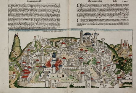
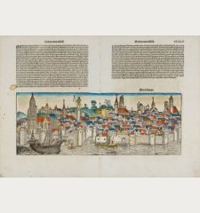
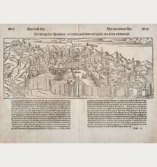
Destruccio Iherosolime
Hartmann Schedel (*1440 - †1514)Reference 11212
Description
Kreuer notes to this map:
This woodcut has relationships to the representation of the city of Jerusalem in the Palestine map by E. Reuwichs in the book by B. Breydenbach of the year 1486, Peregrinatio Terram Sanctam. In addition, parts and structures are based on the detailed Jerusalem view of the epitaph of Adelheid Tucher, Nuremberg. It was created in 1483 by the Master of the High Altar of Hersbrucker for installation in the Bamberg St. James Church. (Compare Hausherr, R., 1987/88, pp. 63 et seq). The topographical notations made by Schedel apparently by reference to the Reuwich map. Another source for the illustration and labeling is likely the work of Josephus, The Jewish War, especially Volume V. and VI. Schedel explicitly states: 'so you want to know it all, read Josephum' (fol. 63). Likewise, Schedel attention to Hieronymus. Given these sources, the authenticity of the view is beyond doubt.
The offered woodcut is one of the oldest authentic plans of Jerusalem and realistically the only large format 15th Century view obtainable to collectors.The woodblock cutters were Michael Wolgemut, the well-known teacher of Albrecht Dürer, and his stepson Wilhelm Pleydenwurff. Wohlgemut was Albrecht Dürer's tutor between 1486-90. Since the young Dürer was active in Wohlgemut's printer shop during the time the woodblock for the Nuremberg Chronicle have produced, he may also have collaborated, since some of the cuts bear a remarkably close resemblance to his Apocalypse illustrations.
Details
| Cartographer | Hartmann Schedel |
| Title | Destruccio Iherosolime |
| Publisher, Year | Anton Koberger, Nuremberg, 1493 |
| Plate Size | 25.3 x 53.4 cm (10.0 x 21.0 inches) |
| Sheet Size | 41.0 x 59.0 cm (16.1 x 23.2 inches) |
| Reference | Kreuer, W., Imago Civitatis, pp. 72-76 |
Condition
Cartographer
Images to Download
If you like to download the image of this map with a resolution of 1200 pixels, please follow the link below.
You can use this image for publication on your personal or commercial websites for free if you set a link to this website. If you need photographs with a higher resolution, please contact us.

![[Die Tafel gibt ein klein anzeigung...] [Die Tafel gibt ein klein anzeigung...]](https://www.vintage-maps.com/1544-home_default/muenster-holy-land-israel-cyprus-1574.jpg)

![[Nile River delta] [Nile River delta]](https://www.vintage-maps.com/2049-home_default/muenster-egypt-nile-river-1574.jpg)
