Produkt wurde in den Korb gelegt
Sie haben 0 Artikel in Ihrem Warenkorb. Es gibt 1 Artikel in Ihrem Warenkorb.
Artikel-Nr. 12197
Beschreibung
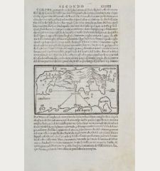
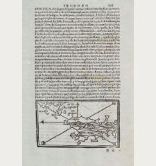
Die zweite gedruckte Karte von Zypern.
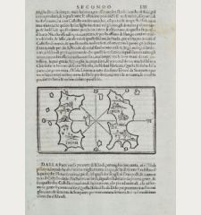
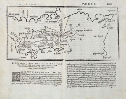
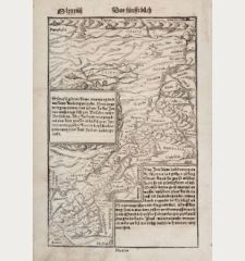
Seltene Holzschnittkarte von Zypern von Benedetto Bordone auf einem Doppelblatt. Von zwei Holzstöcken gedruckt. Zeigt Zypern mit der Südküste der Türkei, im Osten Antiochia und Tripoli (Libanon).
Andreas und Judith A. Stylianou in The History of the Cartography of Cyprus über diese Karte:
Cipro is written inside the map. Comparing the maps of Cyprus from the two Isolari [Bartolomeo and Bordone], we find that they are almost identical. Bernedetto copied Bartolomeo's map, but he corrected the orientation to 'northeast by east' in the text and in the map. He introduced some place-names into his map from Bartolomeo's MS edition, as well as Famagosta and Costanza from the latter's sonnet. He added two rock islands off golfo di pendaia and named them carpasie, a mistake which goes back to Ptolemy. Twenty place-names are marked on the coastline and only nicosia and la croce (Stavrovouni) are marked in the interior. The problem of introducing letters into wood-cut maps had not yet been fully solved.
Aus Libro di Benedetto Bordone... de tutte l'isole del mondo... dem Isolario von Bordone, welches erstmals 1528 in Venedig erschien. Es folgten drei weiter Ausgaben in den Jahren 1534, 1547 und 1565. Die Karten aller vier Ausgaben wurden von denselben Holzstöcken in Venedig gedruckt.
Details
| Kartograph | Benedetto Bordone |
| Titel | Cipro |
| Verlag, Jahr | Venedig, 1528-1565 |
| Bildgröße | 16.0 x 32.7 cm |
| Blattgröße | 29.6 x 38.0 cm |
| Referenz | Stylianou, A. & J.: The History of the Cartography of Cyprus, No. 18 (fig. 21); Zacharakis, C.G.: A Catalogue of Printed Maps of Greece, 1477-1800, No. 540/343 |
Erhaltung
Kartograph
Bilder zum Herunterladen
Falls Sie die Bilder dieser Karte in einer Auflösung von 1200 Pixeln herunterladen möchten, folgen Sie bitte unten stehendem Verweis.
Sie können die Bilder auf Ihrer privaten oder kommerziellen Internetseite frei veröffentlichen, sofern Sie einen Verweis (Link) auf diese Webseite setzen. Falls Sie Fotos in höherer Auflösung benötigen, kontaktieren Sie uns bitte.


![[Die Tafel gibt ein klein anzeigung...] [Die Tafel gibt ein klein anzeigung...]](https://www.vintage-maps.com/1544-home_default/muenster-heiliges-land-israel-zypern-1574.jpg)
![[Asia Minor] [Asia Minor]](https://www.vintage-maps.com/3717-home_default/muenster-tuerkei-kleinasien-1550.jpg)
