Product successfully added to your shopping cart
There are 0 items in your cart. There is 1 item in your cart.
Total products
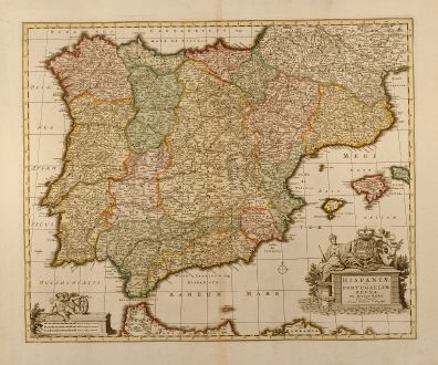
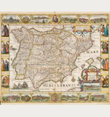
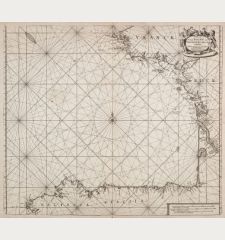
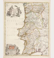
Hispaniae et Portugalliae regna per Nicolaum Visscher
Nicolas Visscher (*1618 - †1679)Coloured map of Spain - Portugal. Printed circa 1720.
Reference 10099
Description
Outstanding example of an Iberian peninsula map showing Spain and Portugal and Balearic Islands. Two beautiful cartouches with several putti and coat of arms. Published by Pieter Schenk from the plate of Nicolas Visscher.
Details
| Cartographer | Nicolas Visscher |
| Title | Hispaniae et Portugalliae regna per Nicolaum Visscher |
| Publisher, Year | circa 1720 |
| Plate Size | 45.8 x 56.0 cm (18.0 x 22.0 inches) |
Condition
Excellent condition with wide margin.
Cartographer
The Visscher family were art and map dealers in Amsterdam during the 17th century. Funded by C. J. Visscher (1587-1652), the business was continued by his son and grandson both named Nicolas. Nicolas Visscher I was born 1618 in Wenns, Austria. He died 1679 in Linz. After the death of Nicolas II, his widow passed the business to Pieter Schenk.
Images to Download
If you like to download the image of this map with a resolution of 1200 pixels, please follow the link below.
You can use this image for publication on your personal or commercial websites for free if you set a link to this website. If you need photographs with a higher resolution, please contact us.
Nicolas Visscher: Hispaniae et Portugalliae regna per Nicolaum Visscher.
Coloured map of Spain - Portugal. Printed circa 1720.
Spain - Portugal - Visscher, Nicolas - Hispaniae et Portugalliae regna per...

![Tabula nova Hispaniae [Tabula noua Hispaniae] Tabula nova Hispaniae [Tabula noua Hispaniae]](https://www.vintage-maps.com/3236-home_default/fries-spain-portugal-1541.jpg)

![[Canary Islands] [Canary Islands]](https://www.vintage-maps.com/3021-home_default/bordone-spain-portugal-canaries-tenerife-gran-canaria.jpg)
